Leimbach-Bentonit
Back to Molasse BasinRepresentation and status
- Index
- L
- Color CMYK
- N/A
- Color RGB
- R: 255 G: 245 B: 255
- Rank
- lithostratigraphic Bed
- Validity
- Unit is in Use
- Status
- informal term
Nomenclature
- Deutsch
- Leimbach-Bentonit
- Français
- Bentonite de Leimbach
- Italiano
- Bentonite di Leimbach
- English
- Leimbach Bentonite
- Origin of the Name
- Historical Variants
-
Leimbacher Tuff (Pavoni 1963), Leimbacher Bentonit-Horizont (Pavoni & Schindler 1981), Leimbach or Riedhof bentonite (Bolliger 1998a), Leimbacher Bentonit (Gubler 1987, Gubler 2009), Leimbach bentonite (Kälin & Kempf 2009).
Description
- Description
-
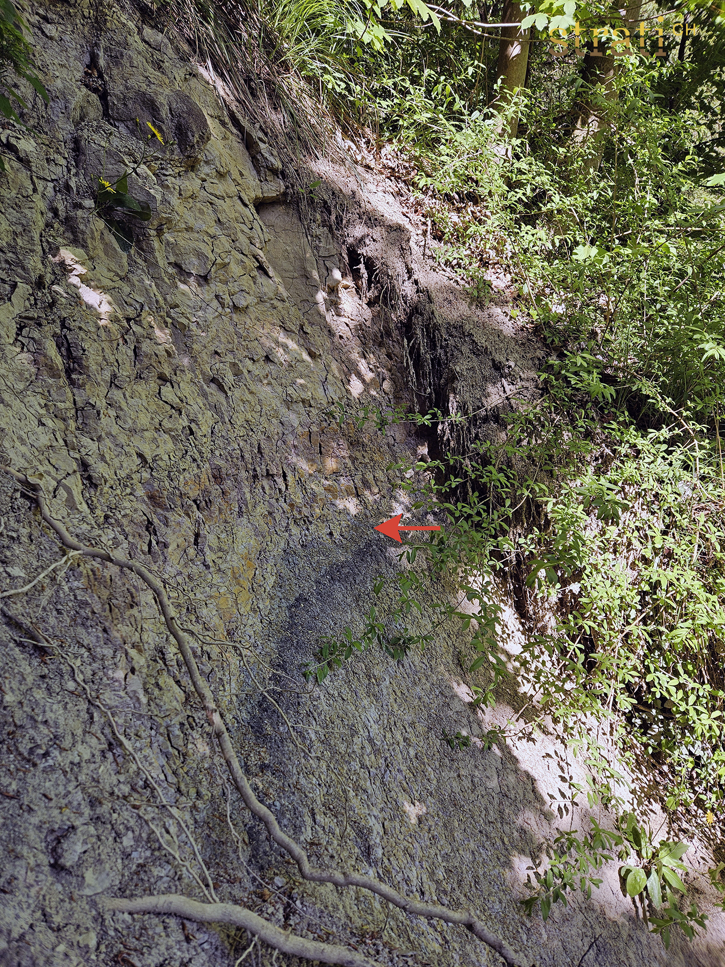
Regionaler Bentonitleithorizont (Ca-Montmorillonit), ca. 300 - 310 m über dem «Appenzellergranit»-Leitniveau. Auf 14.20 +/- 0.08 Ma datiert (Gubler et al 1992).
Hierarchy and sequence
- Superordinate unit
Age
- Age at top
-
- Langhian
- Note about top
-
MN6
- Age at base
-
- Langhian
- Note about base
-
MN6
- Dating Method
-
14.20 ± 0.08 Ma (U/Pb in Zirkonen ; Gubler et al. 1992).
Geography
- Geographical extent
- Aihltal (Rütschlibach bei Leimbach ZH), Albis-Gebiet (Langnau a.A., Hedingertobel), Grüenhaldentobel 2 km SW Birmensdorf.
- Type locality
-
-
Rütschlibach/Falätsche bei Leimbach (ZH)
Site particularities- Obergrenze
- Untergrenze
- typische Fazies
- Bachprofil
- (2680870 / 1243110)
- Gubler et al. 1992, Gubler 2009
-
Rütschlibach/Falätsche bei Leimbach (ZH)
- Type profile
-
-
Rütschlibach/Falätsche bei Leimbach (ZH)
Site particularities- Obergrenze
- Untergrenze
- typische Fazies
- Bachprofil
- (2680870 / 1243110)
- Gubler et al. 1992, Gulber 2009
-
Rütschlibach/Falätsche bei Leimbach (ZH)
- Point of interest
-
-
Langnau am Albis ZH
Site particularities- typische Fazies
- (2681900 / 1237610)
-
Hedingertobel
Site particularities- Obergrenze
- Untergrenze
- typische Fazies
- Bachprofil
- (2677180 / 1239100)
-
Grüenhaldentobel 2 km SW Birmensdorf ZH
Site particularities- Obergrenze
- Untergrenze
- typische Fazies
- Bachprofil
- (2673950 / 1243450)
-
Schwizertobel bei Langnau a.A.
Site particularities- Obergrenze
- Untergrenze
- typische Fazies
- Bachprofil
- (2681575 / 1238165)
-
Langnau am Albis ZH
Palaenography and tectonic
-
- OSM-II
- Paleogeography
- North Alpine Foreland Basin
- Kind of protolith
-
- sedimentary
- volcanic
- Metamorphism
- non metamorphic
References
- Definition
-
(1957) :
Geologie der Zürcher Molasse zwischen Albiskamm und Pfannenstiel. Vjschr. natf. Ges. Zürich 102, 117
S.129
Material and varia
Images